In the context of this PhD Thesis defense, Anna Barra presents her work realized at CTTC.
Abstract:
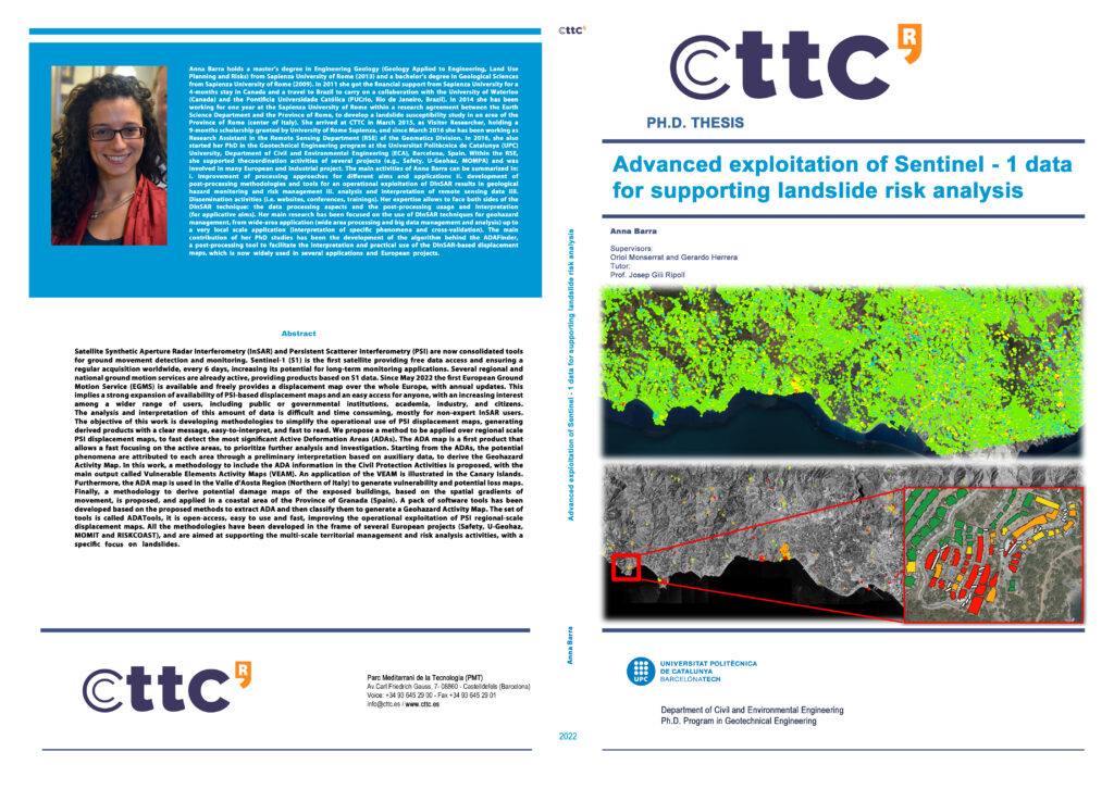
Satellite Synthetic Aperture Radar Interferometry (InSAR) and Persistent Scatterer Interferometry (PSI) are now consolidated tools for ground movement detection and monitoring. Sentinel-1 (S1) is the first satellite providing free data access and ensuring a regular acquisition worldwide, every 6 days, increasing its potential for long-term monitoring applications. Several regional and national ground motion services are already active, providing products based on S1 data. Since May 2022 the first European Ground Motion Service (EGMS) is available and freely provides a displacement map over the whole Europe, with annual updates. This implies a strong expansion of availability of PSI-based displacement maps and an easy access for anyone, with an increasing interest among a wider range of users, including public or governmental institutions, academia, industry, and citizens. The analysis and interpretation of this amount of data is difficult and time consuming, mostly for non-expert InSAR users. The objective of this work is developing methodologies to simplify the operational use of PSI displacement maps, generating derived products with a clear message, easy-to-interpret, and fast to read. We propose a method to be applied over regional scale PSI displacement maps, to fast detect the most significant Active Deformation Areas (ADAs). The ADA map is a first product that allows a fast focusing on the active areas, to prioritize further analysis and investigation. Starting from the ADAs, the potential phenomena are attributed to each area through a preliminary interpretation based on auxiliary data, to derive the Geohazard Activity Map. In this work, a methodology to include the ADA information in the Civil Protection Activities is proposed, with the main output called Vulnerable Elements Activity Maps (VEAM). An application of the VEAM is illustrated in the Canary Islands. Furthermore, the ADA map is used in the Valle d’Aosta Region (Northern of Italy) to generate vulnerability and potential loss maps. Finally, a methodology to derive potential damage maps of the exposed buildings, based on the spatial gradients of movement, is proposed, and applied in a coastal area of the Province of Granada (Spain). A pack of software tools has been developed based on the proposed methods to extract ADA and then classify them to generate a Geohazard Activity Map. The set of tools is called ADATools, it is open-access, easy to use and fast, improving the operational exploitation of PSI regional-scale displacement maps. All the methodologies have been developed in the frame of several European projects (Safety, U-Geohaz, MOMIT and RISKCOAST), and are aimed at supporting the multi-scale territorial management and risk analysis activities, with a specific focus on landslides.
Virtual defense: Click to this link
The virtual defense will be recorded for personal use.